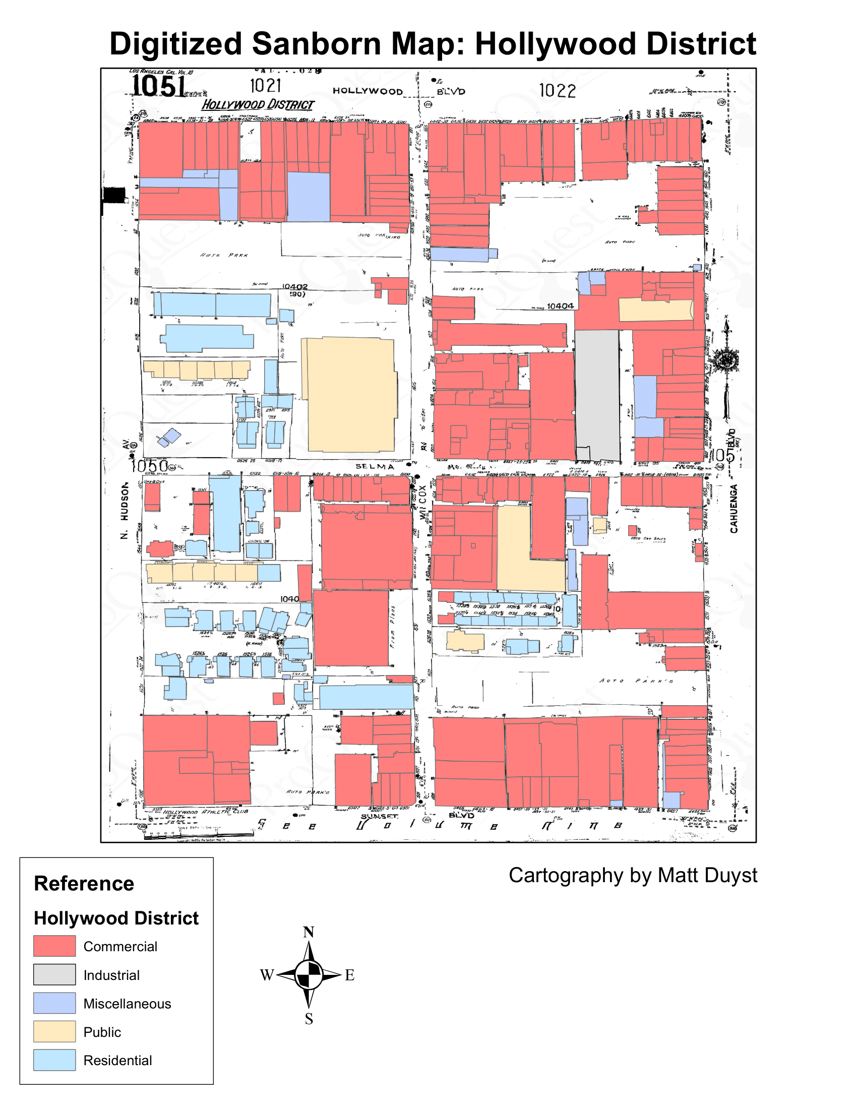
Revitilization of a Sanborn Map: Digitizing Hollywood District
Intro:
This project illustrates the reconstruction of several street blocks of Hollywood in the 1950s through the use of digitizing and vector editing. A blueprint of a 1950 Sanborn fire insurance map was used as the template to create the digitized, print-quality map. The past footprints of the Sanborn map are transferred to its digitized counterpart with visually categorized building types. For those unfamiliar with Hollywood, the northwestern corner of the area represented in the georeferenced GeoTIFF is the intersection between Hollywood Blvd and Cahuenga.
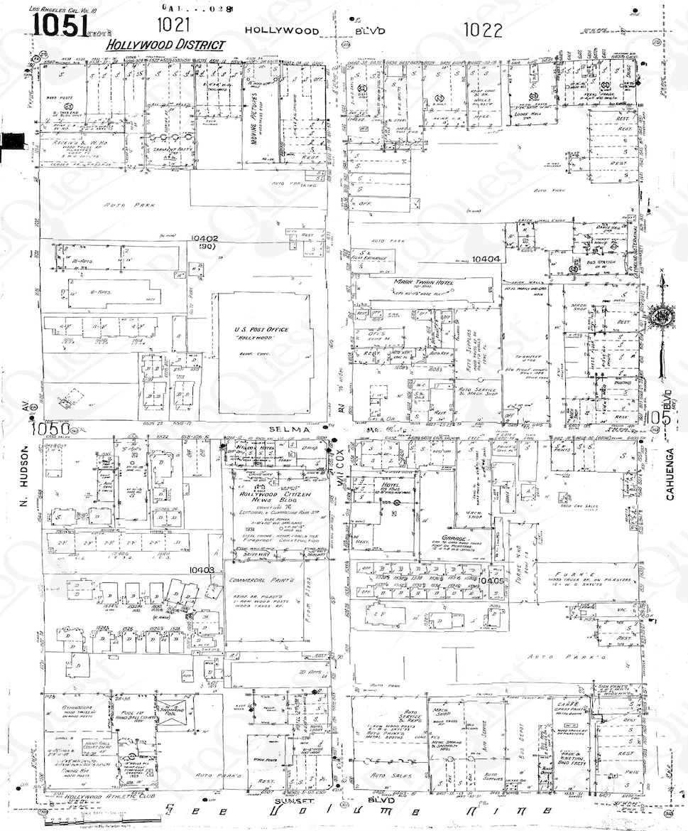
1950 Sanborn Map - A Relic of the Past
Hollywood District - A Digitized Restoration