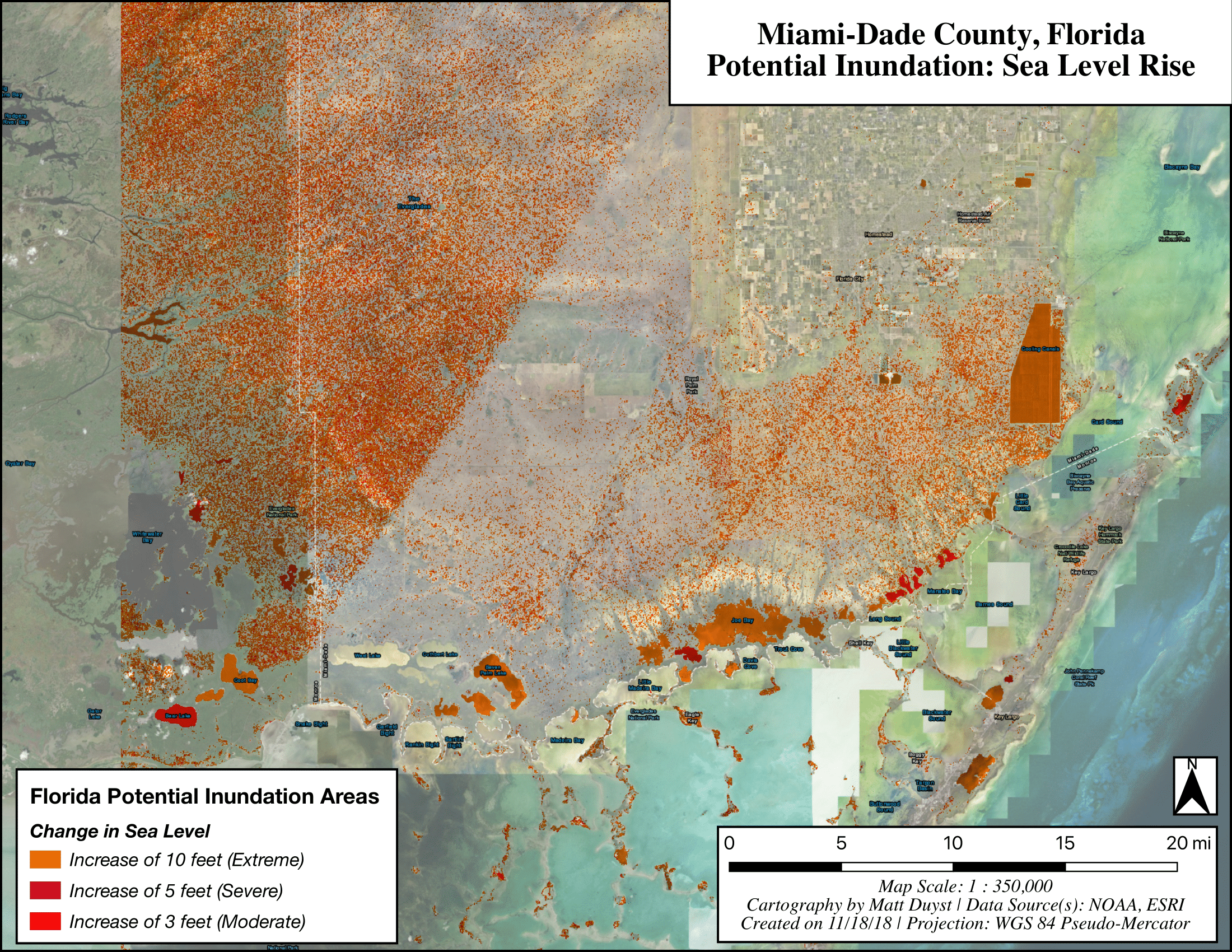
Potential Inundation: Sea Level Rise in Miami-Dade County, Florida
Abstract:
This study explores areas of potential inundation through the analysis of a high-resolution digital elevation model (DEM), and performance of sea level change scenarios of varying severity (Moderate, Severe, and Extreme). The areas of potential inundation are visually superimposed such that the most vulnerable areas appear darker. The application of Boolean expressions using raster calculations allows for the accentuation of areas currently above and below sea level in Miami-Dade County, Florida.
Mapping Sea Level Rise - A DEM of Miami-Dade County